
hua xi zi & Patrick O'Shea
Satellite Image Exchange: The Terminal Vision
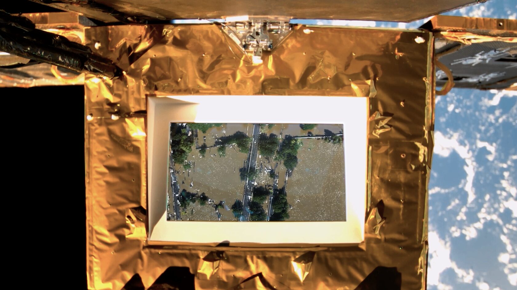
The Terminal Vision displays on the screen of SCA-1 a series of moving-images of the Earth landscape looking down from the satellite, as if the SCA Satellite documents what it sees as it slowly hovers across the Low Earth Orbit. The Terminal Vision is a simulated and imagined reality of the Earth seen at planetary scale, or rather this is the visual condition of the Earth we hope us to urgently see and confront today. These are prompted glimpses of city ruins, destructions, flooding, oil spoils, as well as views of temple labs, empty bunkers, man chopping trees, future city resorts…
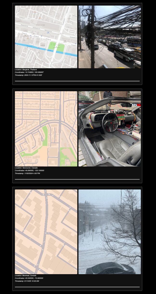
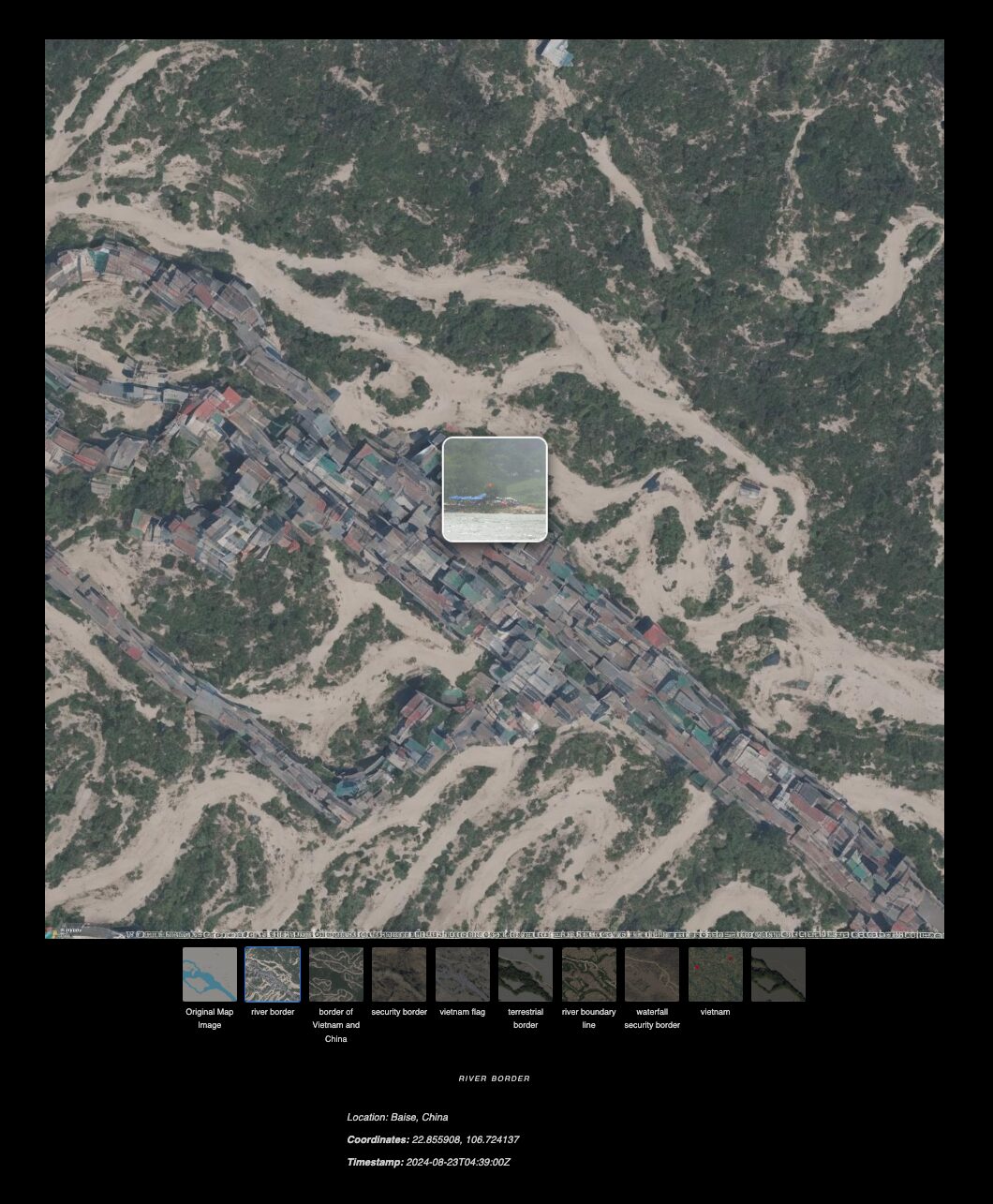
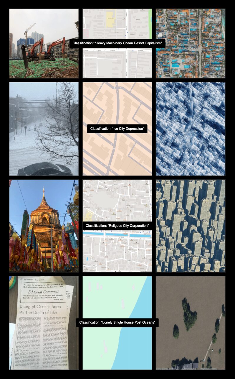
In this first iteration of the total three-track satellite imagery project, Satellite Image Exchange, the artists generate a series of satellite imagery of their own planetary vision from an archive of still photographs they have captured themselves. Each photographic image is therefore mediated into the artists’ self-defined descriptive prompts and a map tile with the image’s geographic coordinates, before being generated into each Earth landscape still with AI processes (We’re self-defining “classifications” and “labels” to each photographic image in order to reverse generate the landscape we wish to see and generate them into satellite images with an open-source model called GeoSynth, a suite of ControlNet adapters fine-tuned on Stable Diffusion, enabling the generation of high-resolution satellite images conditioned on OpenStreetMap map tiles.)
This Earth landscape the satellite flies across is synthesized land. Presented in the vertical perspective of satellite imagery, the images are not only merely documentation or monitoring of all conditions of Earth, but they contain complex realities and representation of gaze produced from the past and present “visual machines,” from the tradition of aerial photography, satellite remote sensing, drone footage, to our everyday photographic captures, and generative AI image models. Rather than acquiring data, however, this “art satellite” displaying our work functions as an emissive platform—the resulting AI-generated landscape is a speculative terrain generated by systems designed to reproduce, extract, and simulate. As much as the synthetic landscapes are imagined, they are the most realistic in simultaneously manmade and machine-generated visions.
Satellite Image Exchange explores planetary projections entangling between photographic captures, satellite remote sensing, machine learning, geospatial map-making, distributed networks, and digital archiving. It is also to build an observation protocol that invites people to share and exchange their imagery visions, making a constantly evolving satellite image body public to all: “What is the world you would like us to see?” Each participation becomes reflective of each other’s geopolitical positions and infrastructural contexts.
This project was initiated and developed as part of the Star Chain of Arts Project participating in the Xu Bing Space Art Residency.
hua xi zi and Patrick O'Shea are a newly formed collective conducting practice-led research that works to reimagine planetary projections and map-making methods to examine colonial historic archives and contemporary technologies.